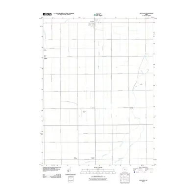
2010 Map of McClure
USGS Topo · Published 2010About this map
The village of McClure serves as a primary hub for this section of Henry County, anchored by the McClure Post Office at a crossroads of late-twentieth-century rural infrastructure. The landscape is defined by a rigid grid of county roads that carve through the agricultural heartland, interrupted only by the meandering paths of Beaver Creek and Hammer Creek to the southeast. These waterways provide a natural counterpoint to the straight lines of Henry Wood Co Line Rd and the surrounding farmland.
Find a feature on this map
39 named features on this map. Tap any name to fly to it.
Don’t see what you’re looking for? This feature index may not catch every label — zoom into the map to look around manually.
Map Details
Editions of this 2010 McClure Map
This is the sole edition of this map. No revisions or reprints were ever made.
Other maps of this area

1908 · Ottawa
USGS Topo · 1:62,500

1908 · Napoleon
USGS Topo · 1:62,500

1909 · Mc Clure
USGS Topo · 1:62,500

1935 · Grand Rapids
USGS Topo · 1:24,000

1940 · Grand Rapids
USGS Topo · 1:31,680
1952 · Grand Rapids
USGS Topo · 1:24,000

1953 · Fort Wayne
USGS Topo · 1:250,000

1956 · Fort Wayne
USGS Topo · 1:250,000

1956 · Toledo
USGS Topo · 1:250,000
1958 · Grand Rapids
USGS Topo · 1:24,000