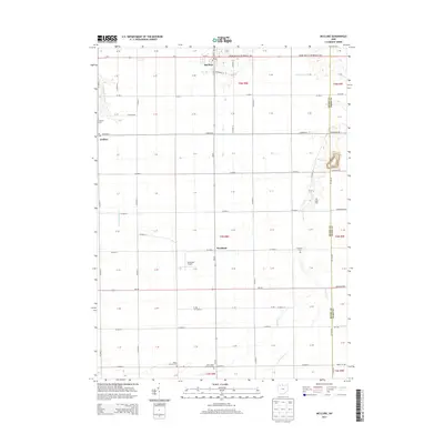
2013 Map of McClure
USGS Topo · Published 2013About this map
McClure stands as the primary hub of this agricultural landscape in Henry County, where the village's grid is centered at the junction of W N St and the Grand Army of the Republic Hwy. The surrounding territory is defined by a dense network of country roads and drainage systems typical of Northwest Ohio, including Beaver Cr and Hammer Cr. Genealogists and local historians will find several burial sites scattered across the townships, such as Grelton Cem in the northwest, Angell Cem near the Wood County line, and the Saint Johns Lutheran Cem to the south. Small rural hamlets like Grelton and Westhope anchor their respective corners of the survey, while the Eickmeier Airport provides a distinct modern landmark among the section lines and farmsteads.
Find a feature on this map
49 named features on this map. Tap any name to fly to it.
Don’t see what you’re looking for? This feature index may not catch every label — zoom into the map to look around manually.
Map Details
Editions of this 2013 McClure Map
This is the sole edition of this map. No revisions or reprints were ever made.
Other maps of this area

1908 · Ottawa
USGS Topo · 1:62,500

1908 · Napoleon
USGS Topo · 1:62,500

1909 · Mc Clure
USGS Topo · 1:62,500

1935 · Grand Rapids
USGS Topo · 1:24,000

1940 · Grand Rapids
USGS Topo · 1:31,680
1952 · Grand Rapids
USGS Topo · 1:24,000

1953 · Fort Wayne
USGS Topo · 1:250,000

1956 · Fort Wayne
USGS Topo · 1:250,000

1956 · Toledo
USGS Topo · 1:250,000
1958 · Grand Rapids
USGS Topo · 1:24,000