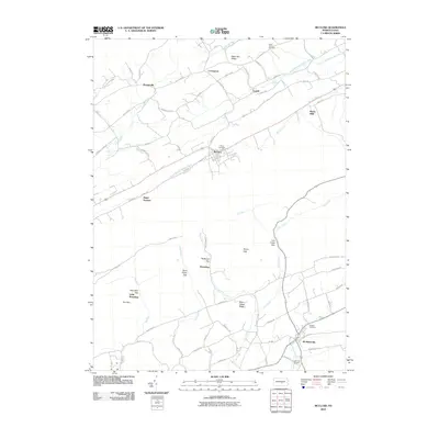
2010 Map of McClure
USGS Topo · Published 2010About this map
McClure stands at the center of this rural landscape, where the South Branch Middle Creek cuts through the valley floor. The settlement pattern here follows the narrow gaps and ridges of central Pennsylvania, with smaller hamlets like Bannerville and Lowell connected by a network of older thoroughfares such as Old Stage Rd and Decatur Rd. The southern portion of the area transitions into the watershed of Lost Creek, which winds toward McAlisterville.
Find a feature on this map
76 named features on this map. Tap any name to fly to it.
Don’t see what you’re looking for? This feature index may not catch every label — zoom into the map to look around manually.
Map Details
Editions of this 2010 McClure Map
This is the sole edition of this map. No revisions or reprints were ever made.
Other maps of this area

1907 · Millerstown
USGS Topo · 1:62,500

1925 · Mifflintown
USGS Topo · 1:48,000

1934 · Mifflintown
USGS Topo · 1:62,500

1937 · Mifflintown
USGS Topo · 1:62,500

1937 · Millheim
USGS Topo · 1:48,000

1938 · Mifflinburg
USGS Topo · 1:48,000

1941 · Millheim
USGS Topo · 1:62,500

1943 · Millerstown
USGS Topo · 1:62,500

1943 · Mifflinburg
USGS Topo · 1:62,500

1950 · Harrisburg
USGS Topo · 1:250,000
Featured Places
- Decatur Township, PA
- McClure, PA
- West Perry Township, PA
- Fayette Township, PA
- Little Roundtop, Fermanagh Township