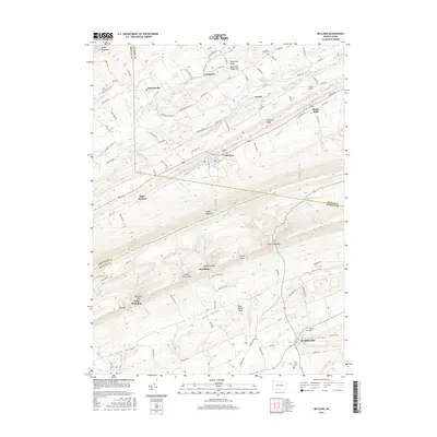
2016 Map of McClure
USGS Topo · Published 2016About this map
McClure and McAlisterville anchor this 2016 study of the ridge-and-valley terrain where Mifflin, Snyder, and Juniata Counties converge. The landscape is defined by the massive parallel rise of Jacks Mountain and Shade Mountain, separated by the drainage of S Br Middle Cr and Beaver Cr. This modern survey details the persistent rural character of central Pennsylvania, tracing the transition from agricultural bottomlands to the wooded heights of Black Oak Ridge and Firestone Ridge. Small historic settlements like Bannerville and Raubs Mills are connected by a network of farm-to-market roads, while local genealogy is preserved at sites like Union Cem and Saint Pauls Cem. The geography reveals how travel and development have long been funneled through natural gaps, including Lost Creek Gap and McAlister Gap, which provide essential passage through the steep terrain.
Find a feature on this map
120 named features on this map. Tap any name to fly to it.
Don’t see what you’re looking for? This feature index may not catch every label — zoom into the map to look around manually.
Map Details
Editions of this 2016 McClure Map
This is the sole edition of this map. No revisions or reprints were ever made.
Other maps of this area

1907 · Millerstown
USGS Topo · 1:62,500

1925 · Mifflintown
USGS Topo · 1:48,000

1934 · Mifflintown
USGS Topo · 1:62,500

1937 · Mifflintown
USGS Topo · 1:62,500

1937 · Millheim
USGS Topo · 1:48,000

1938 · Mifflinburg
USGS Topo · 1:48,000

1941 · Millheim
USGS Topo · 1:62,500

1943 · Millerstown
USGS Topo · 1:62,500

1943 · Mifflinburg
USGS Topo · 1:62,500

1950 · Harrisburg
USGS Topo · 1:250,000
Featured Places
- Decatur Township, PA
- McClure, PA
- West Perry Township, PA
- Fayette Township, PA
- Little Roundtop, Fermanagh Township