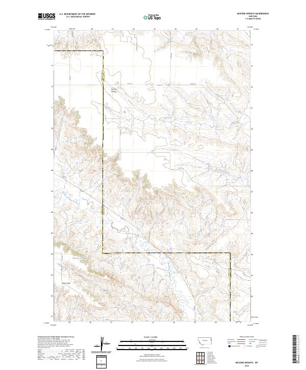
2024 Map of McCone Heights
USGS Topo · Published 2024About this map
McCone Heights sits at the northern edge of this high prairie landscape, where the boundary between Dawson and Richland counties cuts through the broken coulees of eastern Montana. The terrain is defined by dramatic erosional patterns, most notably the broad plateau of Butler Table in the southwest and the winding drainage of Crane Creek. This area illustrates the grid-based settlement patterns of the American West, where section lines and county roads like Co Rd 114 and Co RD 17 navigate a topography carved by North Fork Burns Creek and Dunlap Creek. A specific water source, the 20N56B05AACB01 Spring, provides a rare named hydrological point in this semi-arid ranching country. The map captures the intersection of high-elevation grazing lands and the vital creek beds that supported the region's homesteading history.
Find a feature on this map
24 named features on this map. Tap any name to fly to it.
Don’t see what you’re looking for? This feature index may not catch every label — zoom into the map to look around manually.
Map Details
Editions of this 2024 McCone Heights Map
This is the sole edition of this map. No revisions or reprints were ever made.
Other maps of this area

1909 · Glendive
USGS Topo · 1:250,000

1954 · Glendive
USGS Topo · 1:250,000

1957 · Glendive
USGS Topo · 1:250,000

1958 · Glendive
USGS Topo · 1:250,000

1966 · Crane NW
USGS Topo · 1:24,000

1966 · Knife River Mine
USGS Topo · 1:24,000

1966 · Intake NW
USGS Topo · 1:24,000

1966 · Allard Ranch
USGS Topo · 1:24,000

1966 · Larson School
USGS Topo · 1:24,000

1972 · Butler Table
USGS Topo · 1:24,000