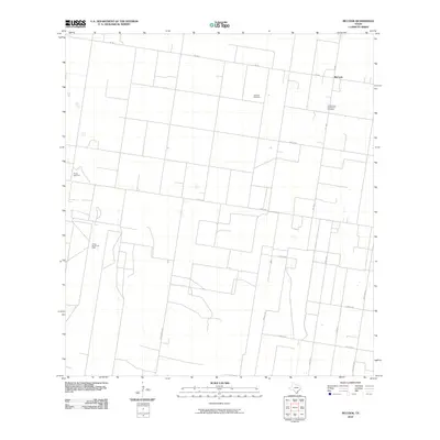
2010 Map of McCook
USGS Topo · Published 2010About this map
McCook anchors the northeastern corner of this South Texas landscape, where the intersection of FM 490 and FM 681 serves as a local hub. The area is defined by a rigorous grid of ranch roads and utility lines, including Mile 16 Rd and Jara Chinas Rd, which segment the terrain for agricultural and industrial use. A notable local landmark is the Immaculate Conception Cemetery, situated just south of the main settlement. Subsurface resources drive much of the local activity, evidenced by the presence of the Javelina Gas Field to the west and the Flores Gas Field and Flores South Gas Field further south. This network of extraction sites and farm-to-market roads illustrates the deep integration of energy production within the rural ranching traditions of Hidalgo County.
Find a feature on this map
18 named features on this map. Tap any name to fly to it.
Don’t see what you’re looking for? This feature index may not catch every label — zoom into the map to look around manually.
Map Details
Editions of this 2010 McCook Map
This is the sole edition of this map. No revisions or reprints were ever made.
Other maps of this area

1938 · Sal Colorada
USGS Topo · 1:62,500

1939 · La Reforma
USGS Topo · 1:62,500

1940 · Monte Christo
USGS Topo · 1:62,500

1949 · Mc Allen
USGS Topo · 1:250,000

1954 · McAllen
USGS Topo · 1:250,000

1956 · Garcias
USGS Topo · 1:62,500

1957 · Mc Allen
USGS Topo · 1:250,000

1962 · McAllen
USGS Topo · 1:250,000

1963 · Monte Christo
USGS Topo · 1:24,000

1963 · Citrus City
USGS Topo · 1:24,000