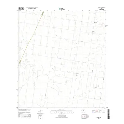
2016 Map of McCook
USGS Topo · Published 2016About this map
McCook anchors the northeastern corner of this South Texas landscape, where the agricultural grid meets the open ranchlands of the Rio Grande Valley. The area is defined by a rigorous network of section-line roads, including 13 Mile Line and 14 Mile Rd, which carve the terrain into large geometric parcels typical of contemporary land management. A prominent cultural landmark, the Immaculate Conception Cem sits along FM 2058, serving as a focal point for local heritage and genealogy. The western edge of the map is defined by the boundary between Starr and Hidalgo counties, where the straight-line surveyor's mark intersects with more winding routes like Ranch Rd 490 and Jara Chinas Rd. This layout illustrates the transition from organized valley farming to the more expansive ranching territories to the west.
Find a feature on this map
19 named features on this map. Tap any name to fly to it.
Don’t see what you’re looking for? This feature index may not catch every label — zoom into the map to look around manually.
Map Details
Editions of this 2016 McCook Map
This is the sole edition of this map. No revisions or reprints were ever made.
Other maps of this area

1938 · Sal Colorada
USGS Topo · 1:62,500

1939 · La Reforma
USGS Topo · 1:62,500

1940 · Monte Christo
USGS Topo · 1:62,500

1949 · Mc Allen
USGS Topo · 1:250,000

1954 · McAllen
USGS Topo · 1:250,000

1956 · Garcias
USGS Topo · 1:62,500

1957 · Mc Allen
USGS Topo · 1:250,000

1962 · McAllen
USGS Topo · 1:250,000

1963 · Monte Christo
USGS Topo · 1:24,000

1963 · Citrus City
USGS Topo · 1:24,000