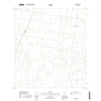
2019 Map of McCook
USGS Topo · Published 2019About this map
The boundary between Starr Co and Hidalgo Co cuts diagonally across this South Texas landscape, defined by expansive agricultural tracts and a grid of rural thoroughfares. Near the northeastern corner, the small community of McCook serves as a local hub, situated where FM 681 meets the grid of mile roads. The area's spiritual and family history is anchored by the Immaculate Conception Cem, located south of town. The terrain is marked by a network of numbered and named arteries such as Mile 17 Rd, Jara Chinas Rd, and Tom Gill Rd, reflecting a systematic division of land typical of the Rio Grande Valley's northern reaches. This 2019 survey documents the enduring ranching and farming character of the region, where roads like Iowa Ave and Texan Rd trace the paths of long-established property lines.
Find a feature on this map
20 named features on this map. Tap any name to fly to it.
Don’t see what you’re looking for? This feature index may not catch every label — zoom into the map to look around manually.
Map Details
Editions of this 2019 McCook Map
This is the sole edition of this map. No revisions or reprints were ever made.
Other maps of this area

1938 · Sal Colorada
USGS Topo · 1:62,500

1939 · La Reforma
USGS Topo · 1:62,500

1940 · Monte Christo
USGS Topo · 1:62,500

1949 · Mc Allen
USGS Topo · 1:250,000

1954 · McAllen
USGS Topo · 1:250,000

1956 · Garcias
USGS Topo · 1:62,500

1957 · Mc Allen
USGS Topo · 1:250,000

1962 · McAllen
USGS Topo · 1:250,000

1963 · Monte Christo
USGS Topo · 1:24,000

1963 · Citrus City
USGS Topo · 1:24,000