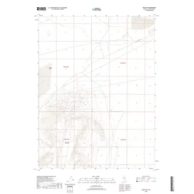
2018 Map of McCoy NW
USGS Topo · Published 2018About this map
The Fish Creek Mountains dominate the southern half of this Lander County landscape, their steep relief defined by dense contouring that rises sharply from the surrounding basins. This 2018 survey documents a remote portion of the Great Basin where drainage is defined by the ephemeral Rock Cr and Willow Cr. To the northwest, the terrain levels into the broad expanse of Buffalo Valley, a classic example of Nevada's basin-and-range topography. In the northeast, the presence of the Copper Basin suggests the region's long-standing connection to mineral exploration. The map provides a precise view of public land survey boundaries, including t30n r42e and t29n r43e, which are essential for locating specific historical mining claims or ranching allotments in this sparsely populated region.
Find a feature on this map
9 named features on this map. Tap any name to fly to it.
Don’t see what you’re looking for? This feature index may not catch every label — zoom into the map to look around manually.
Map Details
Editions of this 2018 McCoy NW Map
This is the sole edition of this map. No revisions or reprints were ever made.
Other maps of this area

1932 · Sonoma Range
USGS Topo · 1:250,000

1939 · Sonoma Range
USGS Topo · 1:250,000

1940 · Antler Peak
USGS Topo · 1:62,500

1943 · Antler Peak
USGS Topo · 1:62,500

1955 · Winnemucca
USGS Topo · 1:250,000

1958 · Winnemucca
USGS Topo · 1:250,000

1961 · McCoy
USGS Topo · 1:62,500

1962 · Winnemucca
USGS Topo · 1:250,000

1962 · Buffalo Springs
USGS Topo · 1:62,500
1965 · Cherry Creek SE
USGS Topo · 1:24,000