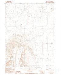
1990 Map of McCoy NW
USGS Topo · Published 1990About this map
The high desert terrain of the Fish Creek Mountains dominates this central Nevada landscape, where the peaks drop sharply into the Buffalo Valley to the west and the Reese River Valley to the east. This 1990 provisional survey documents a remote mining and ranching landscape defined by its water sources and resource exploration. Dozens of sites marked Prospect cluster along the mountain slopes, indicating significant mineral interest and activity in the late 20th century. Named water points such as Pickett Well and Natomas Well serve as vital landmarks in this arid basin-and-range environment. The presence of a Microwave Station on a high ridge near the center of the mountains highlights the modern telecommunications infrastructure required to span these wide Nevada valleys.
Find a feature on this map
15 named features on this map. Tap any name to fly to it.
Don’t see what you’re looking for? This feature index may not catch every label — zoom into the map to look around manually.
Map Details
Editions of this 1990 McCoy NW Map
This is the sole edition of this map. No revisions or reprints were ever made.
Other maps of this area

1932 · Sonoma Range
USGS Topo · 1:250,000

1939 · Sonoma Range
USGS Topo · 1:250,000

1940 · Antler Peak
USGS Topo · 1:62,500

1943 · Antler Peak
USGS Topo · 1:62,500

1955 · Winnemucca
USGS Topo · 1:250,000

1958 · Winnemucca
USGS Topo · 1:250,000

1961 · McCoy
USGS Topo · 1:62,500

1962 · Winnemucca
USGS Topo · 1:250,000

1962 · Buffalo Springs
USGS Topo · 1:62,500
1965 · Cherry Creek SE
USGS Topo · 1:24,000