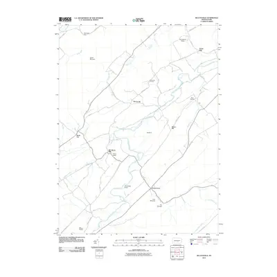
2010 Map of McCoysville
USGS Topo · Published 2010About this map
Tuscarora Creek snakes through the center of this landscape, anchoring a valley of milling settlements and small agricultural hamlets. The prominence of McCullochs Mills and Doyles Mills suggests a history tied to the water power of the creek, while the presence of McCoysville and Honey Grove marks the primary population centers along the local road network. The terrain is sharply defined by the long, parallel ridges of Shade Mountain and the Herringbone Ridges, creating a restricted valley corridor that funnels movement through points like The Narrows and Spectacle Gap.
Find a feature on this map
39 named features on this map. Tap any name to fly to it.
Don’t see what you’re looking for? This feature index may not catch every label — zoom into the map to look around manually.
Map Details
Editions of this 2010 McCoysville Map
This is the sole edition of this map. No revisions or reprints were ever made.
Other maps of this area

1919 · Mattawana
USGS Topo · 1:62,500

1924 · Lewistown
USGS Topo · 1:62,500

1925 · Mifflintown
USGS Topo · 1:48,000

1927 · Lewisburg
USGS Topo · 1:62,500

1930 · Loysville
USGS Topo · 1:62,500

1933 · Loysville
USGS Topo · 1:62,500

1934 · Mifflintown
USGS Topo · 1:62,500

1936 · East Waterford
USGS Topo · 1:48,000

1937 · Mifflintown
USGS Topo · 1:62,500

1941 · East Waterford
USGS Topo · 1:62,500
Featured Places
- Spruce Hill Township, PA
- Jackson Township, PA
- Milford Township, PA
- Northeast Madison Township, PA
- Southwest Madison Township, PA