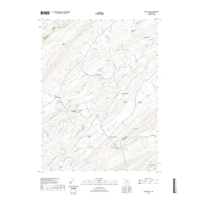
2019 Map of McCoysville
USGS Topo · Published 2019About this map
Tuscarora Creek winds through the heart of the Juniata Valley, anchoring a landscape defined by its agricultural heritage and rural hamlets. The valley floor is punctuated by historic clusters such as McCoysville and McCullochs Mills, where the placement of the McCoysville Cem and McCullochs Mills Cem reflects generations of family settlement. The terrain transitions from the fertile valley to the prominent ridges of Shade Mountain and Blacklog Mountain in the northwest, and Tuscarora Mtn to the southeast. Local transit patterns are visible through gaps like Reeds Gap and Spectacle Gap, which have historically funneled travel through the ridges. Toward the south, Honey Grove sits near The Narrows, a narrow passage where the creek and road are tightly squeezed by Little Mtn, illustrating the topographical constraints on early Pennsylvania infrastructure.
Find a feature on this map
96 named features on this map. Tap any name to fly to it.
Don’t see what you’re looking for? This feature index may not catch every label — zoom into the map to look around manually.
Map Details
Editions of this 2019 McCoysville Map
This is the sole edition of this map. No revisions or reprints were ever made.
Other maps of this area

1919 · Mattawana
USGS Topo · 1:62,500

1924 · Lewistown
USGS Topo · 1:62,500

1925 · Mifflintown
USGS Topo · 1:48,000

1927 · Lewisburg
USGS Topo · 1:62,500

1930 · Loysville
USGS Topo · 1:62,500

1933 · Loysville
USGS Topo · 1:62,500

1934 · Mifflintown
USGS Topo · 1:62,500

1936 · East Waterford
USGS Topo · 1:48,000

1937 · Mifflintown
USGS Topo · 1:62,500

1941 · East Waterford
USGS Topo · 1:62,500
Featured Places
- Spruce Hill Township, PA
- Jackson Township, PA
- Milford Township, PA
- Northeast Madison Township, PA
- Southwest Madison Township, PA