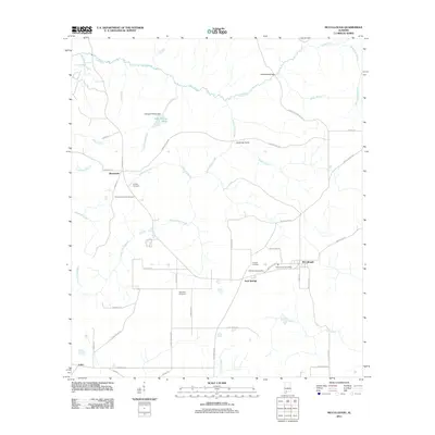
2011 Map of McCullough
USGS Topo · Published 2011About this map
The McCullough Post Office serves as a central hub for this Escambia County community, situated in a landscape defined by its rural road networks and numerous family cemeteries. The area is intersected by watercourses such as Little River and Bell Creek, which wind through the terrain alongside established settlements like Booneville and Jack Springs. A significant number of local burial grounds, including the Lindsey Cemetery, Steadham Cemetery, and Driskell Cemetery, reflect the deep-rooted history of the resident families in this corner of Alabama.
Find a feature on this map
59 named features on this map. Tap any name to fly to it.
Don’t see what you’re looking for? This feature index may not catch every label — zoom into the map to look around manually.
Map Details
Editions of this 2011 McCullough Map
This is the sole edition of this map. No revisions or reprints were ever made.
Other maps of this area

1942 · Perdido
USGS Topo · 1:62,500

1944 · Perdido
USGS Topo · 1:62,500

1953 · Andalusia
USGS Topo · 1:250,000

1957 · Andalusia
USGS Topo · 1:250,000

1960 · Atmore
USGS Topo · 1:24,000

1960 · Huxford
USGS Topo · 1:24,000

1972 · Uriah East
USGS Topo · 1:24,000

1972 · Chrysler
USGS Topo · 1:24,000

1972 · Uriah West
USGS Topo · 1:24,000
1983 · McCullough
USGS Topo · 1:24,000