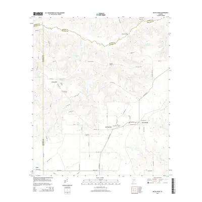
2014 Map of McCullough
USGS Topo · Published 2014About this map
Little River defines the northern reaches of this landscape, winding through a complex topography where the borders of Monroe, Escambia, and Baldwin counties converge. This 2014 survey reveals a rural settlement pattern deeply rooted in family and community burial grounds, from the Mothershed Cem in the north to the cluster of Jack Springs Cem and Driskell Cem near the town of Jack Springs. The terrain is marked by numerous drainage systems like Long Hollow Cr and Bell Cr, while man-made water features such as Lake George (White) punctuate the timbered and agricultural interior. The road network, including the historic Stage Coach Rd near Lottie and the grid of Three Mile Rd, illustrates how transportation has adapted to the natural gullies and creek beds of southern Alabama.
Find a feature on this map
68 named features on this map. Tap any name to fly to it.
Don’t see what you’re looking for? This feature index may not catch every label — zoom into the map to look around manually.
Map Details
Editions of this 2014 McCullough Map
This is the sole edition of this map. No revisions or reprints were ever made.
Other maps of this area

1942 · Perdido
USGS Topo · 1:62,500

1944 · Perdido
USGS Topo · 1:62,500

1953 · Andalusia
USGS Topo · 1:250,000

1957 · Andalusia
USGS Topo · 1:250,000

1960 · Atmore
USGS Topo · 1:24,000

1960 · Huxford
USGS Topo · 1:24,000

1972 · Uriah East
USGS Topo · 1:24,000

1972 · Chrysler
USGS Topo · 1:24,000

1972 · Uriah West
USGS Topo · 1:24,000
1983 · McCullough
USGS Topo · 1:24,000