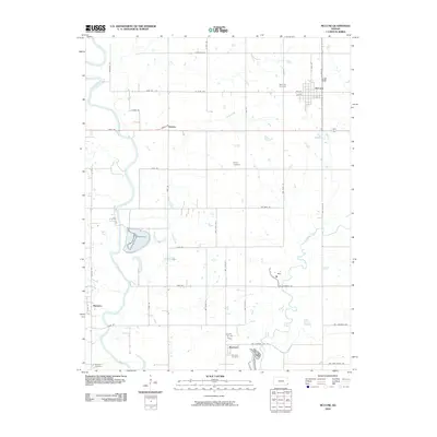
2010 Map of McCune
USGS Topo · Published 2010About this map
McCune serves as the primary grid-pattern settlement in this southeastern Kansas landscape, which is defined by a dense network of sectional roads and meandering watercourses. The drainage of Lightning Creek and Litup Creek flows generally southward, eventually nearing the Neosho River which cuts across the southwestern corner of the quadrangle near Montana. This rural area preserves several burial sites of interest to genealogists, including Mc Cune Cemetery north of the town center and Harley Cemetery to the south. Small clusters of development at Strauss and Sherman illustrate the historic distribution of tiny agricultural hubs across Crawford County. The proximity of Sherman Cemetery to its namesake settlement and the isolated Mitchell Cemetery near the river highlight the long-standing community foundations in this corner of the state.
Find a feature on this map
44 named features on this map. Tap any name to fly to it.
Don’t see what you’re looking for? This feature index may not catch every label — zoom into the map to look around manually.
Map Details
Editions of this 2010 McCune Map
This is the sole edition of this map. No revisions or reprints were ever made.
Other maps of this area

1886 · Joplin
USGS Topo · 1:125,000

1886 · Parsons
USGS Topo · 1:125,000

1893 · Parsons
USGS Topo · 1:125,000

1894 · Joplin
USGS Topo · 1:125,000

1918 · Columbus
USGS Topo · 1:62,500

1943 · McCune
USGS Topo · 1:62,500

1943 · Cherokee
USGS Topo · 1:62,500

1944 · Oswego
USGS Topo · 1:62,500

1945 · Mc Cune
USGS Topo · 1:62,500

1945 · Cherokee
USGS Topo · 1:62,500