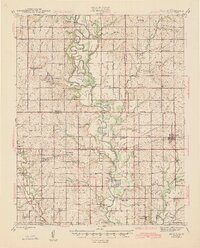
1945 Map of McCune
USGS Topo · Published 1945About this map
The Neosho River meanders through this mid-1940s landscape, creating a complex network of oxbows and riparian lakes such as Halfmoon Lake, Black Lake, and Lake McKinley. This region, where Neosho, Labette, Crawford, and Cherokee counties converge, reveals a dense network of rural infrastructure centered on the family farm and local education. A remarkable density of country schoolhouses, including the uniquely named Stone Palace Sch, Pea Ridge Sch, and Odell Sch, suggests a vibrant, decentralized community life during this era.
Find a feature on this map
67 named features on this map. Tap any name to fly to it.
Don’t see what you’re looking for? This feature index may not catch every label — zoom into the map to look around manually.
Map Details
Editions of this 1945 McCune Map
2 editions found

Other maps of this area

1884 · Fort Scott
USGS Topo · 1:125,000

1886 · Joplin
USGS Topo · 1:125,000

1886 · Iola
USGS Topo · 1:125,000

1886 · Fort Scott
USGS Topo · 1:125,000

1886 · Parsons
USGS Topo · 1:125,000

1893 · Fort Scott
USGS Topo · 1:125,000

1893 · Iola
USGS Topo · 1:125,000

1893 · Parsons
USGS Topo · 1:125,000

1894 · Joplin
USGS Topo · 1:125,000

1904 · Iola
USGS Topo · 1:125,000