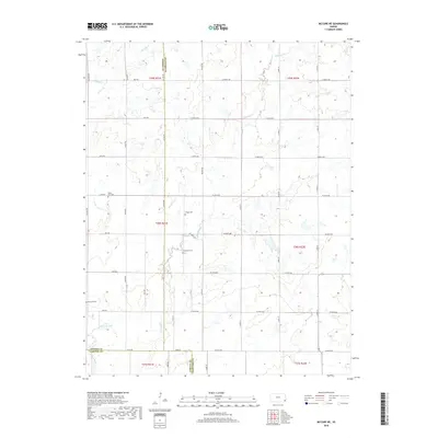
2018 Map of McCune NE
USGS Topo · Published 2018About this map
Valley City Cem and Frogge Cem sit within the rural landscape of Crawford County, where agricultural fields are partitioned by an orderly grid of section-line roads like Xavier Rd and S 50th St. This area, situated at the junction of Crawford, Neosho, and Labette counties, is defined by the winding paths of Hickory Cr and Murphy Cr as they drain toward the southern corner of the map. Near the southwestern boundary, the Neosho River and Little Halfmoon Lake indicate a more complex riparian environment. The distribution of small family and community burial grounds, including Dumbauld Cem and Richland Cem, suggests a long-standing pattern of dispersed homesteading and small-town settlement along the Kansas borderlands.
Find a feature on this map
44 named features on this map. Tap any name to fly to it.
Don’t see what you’re looking for? This feature index may not catch every label — zoom into the map to look around manually.
Map Details
Editions of this 2018 McCune NE Map
This is the sole edition of this map. No revisions or reprints were ever made.
Other maps of this area

1884 · Fort Scott
USGS Topo · 1:125,000

1886 · Joplin
USGS Topo · 1:125,000

1886 · Iola
USGS Topo · 1:125,000

1886 · Fort Scott
USGS Topo · 1:125,000

1886 · Parsons
USGS Topo · 1:125,000

1893 · Fort Scott
USGS Topo · 1:125,000

1893 · Iola
USGS Topo · 1:125,000

1893 · Parsons
USGS Topo · 1:125,000

1894 · Joplin
USGS Topo · 1:125,000

1904 · Iola
USGS Topo · 1:125,000