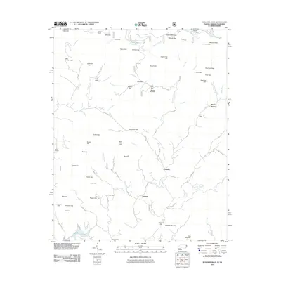
2011 Map of McDaniel Bald
USGS Topo · Published 2011About this map
McDaniel Bald and the surrounding high ridges of the Unicoi Mountains define this landscape on the North Carolina-Tennessee border. Small communities like Ebenezer and Grandview are situated along the winding valley roads, particularly following the path of Hanging Dog Creek. The area is characterized by a dense network of gaps and tops named for local figures and landmarks, including Farmer Top, Graham Top, and Peter Dick Gap. For genealogists, the map identifies family-named burial grounds such as Bryson Cemetery and James Cemetery. The drainage patterns are intricate, with several watercourses like Davis Creek and Owl Creek feeding into the local system. To the south, the presence of Persimmon Lake and the various branches of Grape Creek indicate the varied hydrology of the Cherokee County interior before it meets the higher elevations of Chestnut Mountain to the north.
Find a feature on this map
96 named features on this map. Tap any name to fly to it.
Don’t see what you’re looking for? This feature index may not catch every label — zoom into the map to look around manually.
Map Details
Editions of this 2011 McDaniel Bald Map
This is the sole edition of this map. No revisions or reprints were ever made.
Other maps of this area

1893 · Murphy
USGS Topo · 1:125,000

1914 · Murphy
USGS Topo · 1:125,000

1927 · Big Junction
USGS Topo · 1:24,000

1933 · Haw Knob
USGS Topo · 1:48,000

1933 · Bald River Falls
USGS Topo · 1:24,000

1934 · Murphy
USGS Topo · 1:24,000

1934 · Persimmon Creek
USGS Topo · 1:24,000

1934 · McDaniel Bald
USGS Topo · 1:24,000

1934 · Unaka
USGS Topo · 1:24,000

1934 · Murphy
USGS Topo · 1:48,000