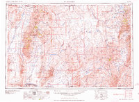
1959 Map of McDermitt
USGS Topo · Published 1959About this map
The Santa Rosa Range dominates this mid-century portrait of the Nevada-Oregon borderlands, where high-desert ranching and deep-earth mining define the local economy. At the northern edge, the Fort McDermitt Indian Res straddles the state line, while the Western Shoshone Indian Reservation sits to the east near the Independence Mountains. The map documents a significant industrial footprint in the mid-1950s, highlighting several major operations such as the Getchell Mine, the Riley Mine, and the National Mine. Settlement patterns follow the water, with McDermitt and Orovada positioned along the Quinn River Valley, and Paradise Valley tucked between the Santa Rosa Peak and the Hot Springs Range. Transport is anchored by the north-south corridor of U.S. 95 and the Western Pacific RR skirting the southern boundary near Winnemucca.
Find a feature on this map
115 named features on this map. Tap any name to fly to it.
Don’t see what you’re looking for? This feature index may not catch every label — zoom into the map to look around manually.
Map Details
Editions of this 1959 McDermitt Map
2 editions found

Other maps of this area

1882 · Paradise
USGS Topo · 1:250,000

1886 · Disaster
USGS Topo · 1:250,000

1893 · Paradise
USGS Topo · 1:250,000

1893 · Disaster
USGS Topo · 1:250,000

1931 · Lovelock
USGS Topo · 1:250,000

1932 · Sonoma Range
USGS Topo · 1:250,000

1935 · Lovelock
USGS Topo · 1:250,000

1936 · Mountain City
USGS Topo · 1:62,500

1939 · Sonoma Range
USGS Topo · 1:250,000

1939 · Owyhee
USGS Topo · 1:62,500