
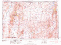
1959 Map of McDermitt
USGS Topo · Published 1959About this map
McDermitt sits at the northern edge of this high-desert landscape where the Quinn River Valley meets the Oregon border. The survey details a remote interior of the Great Basin during the late 1950s, defined by high ranges like the Santa Rosa Range and the Tuscarora Mountains. The map reveals an economy still deeply tied to mineral extraction, showing the Cordero Mine and the Mountain View Mine (gold), alongside several sites already noted as inactive, such as the Cornucopia Mine (Silver abandoned).
Find a feature on this map
118 named features on this map. Tap any name to fly to it.
Don’t see what you’re looking for? This feature index may not catch every label — zoom into the map to look around manually.
Map Details
Editions of this 1959 McDermitt Map
2 editions found
Other maps of this area

1882 · Paradise
USGS Topo · 1:250,000

1886 · Disaster
USGS Topo · 1:250,000

1893 · Paradise
USGS Topo · 1:250,000

1893 · Disaster
USGS Topo · 1:250,000

1931 · Lovelock
USGS Topo · 1:250,000

1932 · Sonoma Range
USGS Topo · 1:250,000

1935 · Lovelock
USGS Topo · 1:250,000

1936 · Mountain City
USGS Topo · 1:62,500

1939 · Sonoma Range
USGS Topo · 1:250,000

1939 · Owyhee
USGS Topo · 1:62,500