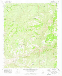
1973 Map of McDonald Mtn
USGS Topo · Published 1975About this map
Green Valley and the surrounding high country of the Tonto National Forest are defined by a complex network of canyons and livestock watering infrastructure in the early 1970s. The landscape is dotted with evidence of ranching history and early homesteading, such as the Neal Cabin and the Old Rock House located near the Springs south of Wolverton Mtn. This U. S. Forest Service data shows a terrain where water management was paramount, indicated by numerous named tanks like Butte Tank, Hole in the Ground Tank, and Picket Pen Tank. Significant topographical markers like The Buttes and McDonald Mountain rise above the deep washes of Stewart Creek and Soldier Camp creek, providing a clear picture of the isolated cattle country and the rugged transportation routes like the many pack trails used to navigate the Brushy Basin and Blue Dog Ridge.
Find a feature on this map
71 named features on this map. Tap any name to fly to it.
Don’t see what you’re looking for? This feature index may not catch every label — zoom into the map to look around manually.
Map Details
Editions of this 1973 McDonald Mtn Map
This is the sole edition of this map. No revisions or reprints were ever made.
Other maps of this area

1887 · Verde
USGS Topo · 1:250,000

1892 · Verde
USGS Topo · 1:250,000

1934 · Pine
USGS Topo · 1:62,500

1934 · Promontory Butte
USGS Topo · 1:62,500

1936 · Payson
USGS Topo · 1:48,000

1937 · Diamond Butte
USGS Topo · 1:48,000

1939 · Promontory Butte
USGS Topo · 1:62,500

1940 · Pine
USGS Topo · 1:62,500

1942 · Payson
USGS Topo · 1:62,500

1943 · Diamond Butte
USGS Topo · 1:62,500