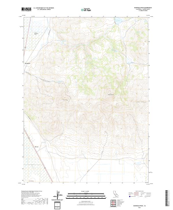
2021 Map of McDonald Peak
USGS Topo · Published 2021About this map
Madeline Plains and the high desert terrain of northeastern California define this landscape, where water sources are vital landmarks for local history. The high elevation of McDonald Peak stands over a network of intermittent drainages and essential springs like Poulsen Spring and Harrington Spring. Small settlements such as Brockman and Moran provide points of reference along the western edge of the quadrangle, connected by roads such as Mendiboure Rd. The reliance on water management is evident in the presence of several reservoirs, including Mendiboure Reservoir, Van Loun Reservoir, and Threemile Reservoir. This 2021 survey illustrates the modern configuration of range lands and public land survey boundaries, such as t36n r13e, across the broad expanse of Skeleton Flat and the prominent Three Peaks.
Find a feature on this map
28 named features on this map. Tap any name to fly to it.
Don’t see what you’re looking for? This feature index may not catch every label — zoom into the map to look around manually.
Map Details
Editions of this 2021 McDonald Peak Map
This is the sole edition of this map. No revisions or reprints were ever made.
Other maps of this area

1886 · Alturas
USGS Topo · 1:250,000

1886 · Honey Lake
USGS Topo · 1:250,000

1891 · Honey Lake
USGS Topo · 1:250,000

1892 · Alturas
USGS Topo · 1:250,000

1893 · Honey Lake
USGS Topo · 1:250,000

1954 · Grasshopper Valley
USGS Topo · 1:62,500

1954 · Ravendale
USGS Topo · 1:62,500

1954 · Alturas
USGS Topo · 1:250,000

1955 · Westwood
USGS Topo · 1:250,000

1958 · Alturas
USGS Topo · 1:250,000