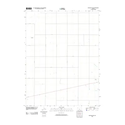
2009 Map of McDonald SW
USGS Topo · Published 2009About this map
North Beaver Creek cuts a diagonal path through this section of Rawlins County, defining the drainage patterns of an otherwise strictly organized agricultural landscape. The region is defined by a rigorous grid of section lines, including Co Rd 31 and Co Rd 34, which facilitate the transport of crops across this corner of the High Plains. While the area is largely dedicated to large-scale farming, the presence of Evergreen Cemetery in the northwest and Grace Cemetery in the southeast serves as a reminder of the long-standing rural community and its deep ties to the land. These small, dedicated plots are the primary landmarks in a landscape otherwise dominated by the seasonal rhythms of the Kansas plains.
Find a feature on this map
15 named features on this map. Tap any name to fly to it.
Don’t see what you’re looking for? This feature index may not catch every label — zoom into the map to look around manually.
Map Details
Editions of this 2009 McDonald SW Map
This is the sole edition of this map. No revisions or reprints were ever made.
Other maps of this area

1950 · Mc Donald
USGS Topo · 1:62,500

1951 · Bird City North
USGS Topo · 1:62,500

1951 · Mc Donald
USGS Topo · 1:62,500

1951 · Bird City South
USGS Topo · 1:62,500

1951 · Dewey Ranch
USGS Topo · 1:62,500

1954 · Goodland
USGS Topo · 1:250,000

1956 · Goodland
USGS Topo · 1:250,000

1957 · Goodland
USGS Topo · 1:250,000

1976 · Bird City North
USGS Topo · 1:24,000
1976 · Henkle Canyon
USGS Topo · 1:24,000