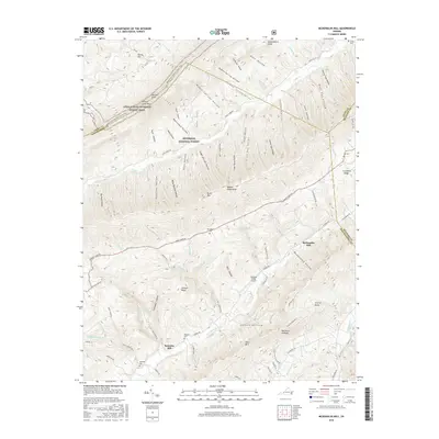
2016 Map of McDonalds Mill
USGS Topo · Published 2016About this map
The N Fork Roanoke River valley serves as the central artery for this portion of Montgomery County, where the historic settlements of Bennetts Mill and McDonalds Mill anchor a landscape defined by sharp ridgelines and narrow hollows. In the northern reaches of the Jefferson National Forest, the Appalachian National Scenic Trail traverses the crest of Craig Creek Mtn, providing a vantage point over a complex network of drainages like Sinking Cr and Craig Cr. Family history is deeply rooted here, evidenced by several small burial grounds such as Alts Cem and Whitelock Cem positioned along the slopes. The presence of the Catawba Valley Airport near Jack Hollow indicates the persistence of small-scale aviation within these mountain gaps, while unique geological markers like Acre of Rocks and Half Acre of Rocks dot the terrain south of Paris Mtn.
Find a feature on this map
82 named features on this map. Tap any name to fly to it.
Don’t see what you’re looking for? This feature index may not catch every label — zoom into the map to look around manually.
Map Details
Editions of this 2016 McDonalds Mill Map
This is the sole edition of this map. No revisions or reprints were ever made.
Other maps of this area

1890 · Christiansburg
USGS Topo · 1:125,000

1923 · Waiteville
USGS Topo · 1:62,500

1929 · Salem
USGS Topo · 1:48,000

1931 · Waiteville
USGS Topo · 1:48,000

1932 · Salem
USGS Topo · 1:62,500

1932 · Blacksburg
USGS Topo · 1:48,000

1937 · Blacksburg
USGS Topo · 1:62,500

1944 · Waiteville
USGS Topo · 1:62,500

1950 · Elliston
USGS Topo · 1:62,500

1951 · Waiteville
USGS Topo · 1:62,500