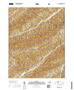
2019 Map of McDonalds Mill
USGS Topo · Published 2019About this map
Jefferson National Forest dominates the high-elevation terrain of this region where the boundaries of Montgomery, Craig, and Roanoke counties converge. The landscape is defined by a dense network of hollows—such as Ruben Springs Hollow, Sugar House Hollow, and Leyman Hollow—that descend from steep ridges toward the valley floors. Small settlements and mill sites like McDonalds Mill and Bennetts Mill anchor the lower elevations, situated along watercourses like the N Fork Roanoke River and Craig Creek. For genealogists and local historians, the presence of family-linked sites such as Whitelock Cem, Bennett Cem, and Anderson Cem provides clear evidence of long-standing community roots in the valley. The Appalachian National Scenic Trail winds through the northern peaks, illustrating the area's role as a recreation corridor, while the Catawba Valley Airport serves as a small aviation landmark amidst the ridges.
Find a feature on this map
92 named features on this map. Tap any name to fly to it.
Don’t see what you’re looking for? This feature index may not catch every label — zoom into the map to look around manually.
Map Details
Editions of this 2019 McDonalds Mill Map
This is the sole edition of this map. No revisions or reprints were ever made.
Other maps of this area

1890 · Christiansburg
USGS Topo · 1:125,000

1923 · Waiteville
USGS Topo · 1:62,500

1929 · Salem
USGS Topo · 1:48,000

1931 · Waiteville
USGS Topo · 1:48,000

1932 · Salem
USGS Topo · 1:62,500

1932 · Blacksburg
USGS Topo · 1:48,000

1937 · Blacksburg
USGS Topo · 1:62,500

1944 · Waiteville
USGS Topo · 1:62,500

1950 · Elliston
USGS Topo · 1:62,500

1951 · Waiteville
USGS Topo · 1:62,500