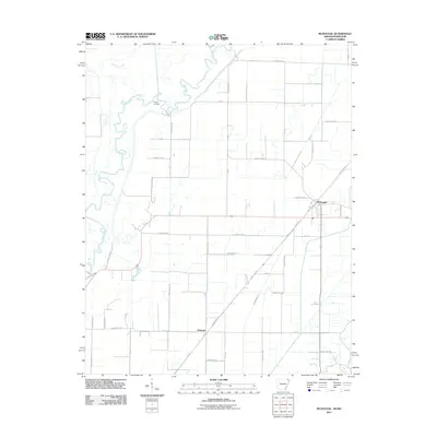
2011 Map of McDougal
USGS Topo · Published 2011About this map
Black River meanders through the western reaches of this Clay County landscape, creating a complex series of oxbows and wetlands near Moark Landing. This topography transitions into a strictly ordered agricultural grid to the east, where the natural hydrology has been heavily modified by an extensive network of drainage channels. Features like Ditch Number 17, Ditch Number 19, and Ditch Number 13 define the modern reclaimed landscape, facilitating large-scale farming in the alluvial plains. The primary population centers of McDougal and Hickoria serve as the focal points for the rural road network. A notable remnant of earlier transit persists with the label Tram Rd southwest of McDougal, hinting at the area's history of timber extraction or localized transport before the dominance of the modern county road system.
Find a feature on this map
43 named features on this map. Tap any name to fly to it.
Don’t see what you’re looking for? This feature index may not catch every label — zoom into the map to look around manually.
Map Details
Editions of this 2011 McDougal Map
This is the sole edition of this map. No revisions or reprints were ever made.
Other maps of this area

1935 · Acorn
USGS Topo · 1:62,500

1935 · Rector
USGS Topo · 1:62,500

1935 · Knobel
USGS Topo · 1:62,500

1935 · Harviell
USGS Topo · 1:62,500

1940 · Naylor
USGS Topo · 1:62,500

1941 · Knobel
USGS Topo · 1:62,500

1944 · Naylor
USGS Topo · 1:62,500

1957 · Poplar Bluff
USGS Topo · 1:250,000

1958 · Rector
USGS Topo · 1:62,500

1959 · Poplar Bluff
USGS Topo · 1:250,000