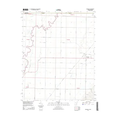
2014 Map of McDougal
USGS Topo · Published 2014About this map
McDougal stands as the primary hub in this corner of Northeast Arkansas, situated just below the Missouri border where the flatlands of the Mississippi Alluvial Plain meet complex drainage systems. The landscape is defined by the winding course of the Black River, which meanders through the western portion of the map, while the surrounding agricultural lands are meticulously organized by a network of man-made waterways like Ditch Number 13 and Ditch Number 17.
Find a feature on this map
57 named features on this map. Tap any name to fly to it.
Don’t see what you’re looking for? This feature index may not catch every label — zoom into the map to look around manually.
Map Details
Editions of this 2014 McDougal Map
This is the sole edition of this map. No revisions or reprints were ever made.
Other maps of this area

1935 · Acorn
USGS Topo · 1:62,500

1935 · Rector
USGS Topo · 1:62,500

1935 · Knobel
USGS Topo · 1:62,500

1935 · Harviell
USGS Topo · 1:62,500

1940 · Naylor
USGS Topo · 1:62,500

1941 · Knobel
USGS Topo · 1:62,500

1944 · Naylor
USGS Topo · 1:62,500

1957 · Poplar Bluff
USGS Topo · 1:250,000

1958 · Rector
USGS Topo · 1:62,500

1959 · Poplar Bluff
USGS Topo · 1:250,000