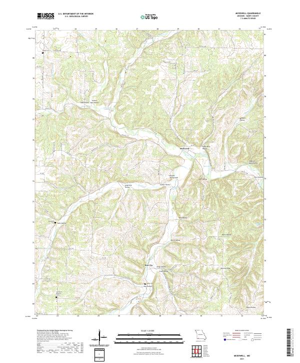
2021 Map of McDowell
USGS Topo · Published 2021About this map
Flat Creek and its many tributaries carve a complex network of narrow valleys through Barry County, Missouri, creating a landscape defined by names like Sugartree Hollow, Onion Hollow, and Swallow Bluff Hollow. The small community of McDowell sits at the confluence of Little Flat Cr and the main branch, while Star City is situated further south among the ridges. For those researching local family history, several burial sites are documented across the terrain, including Bethel Cem in the north and Sparks Cem near Dog Hollow. The presence of Log Church Memorial Gardens and Bullington Cem further highlights the area's established rural character. Natural water sources are abundant, with Hilton Spring, Brights Spring, and Wall Bluff Spring emerging from the limestone-heavy topography between Bennett Ridge and the winding creek beds.
Find a feature on this map
74 named features on this map. Tap any name to fly to it.
Don’t see what you’re looking for? This feature index may not catch every label — zoom into the map to look around manually.
Map Details
Editions of this 2021 McDowell Map
This is the sole edition of this map. No revisions or reprints were ever made.
Other maps of this area

1927 · Shell Knob
USGS Topo · 1:62,500

1937 · Cassville
USGS Topo · 1:48,000

1942 · Aurora
USGS Topo · 1:62,500

1943 · Monett
USGS Topo · 1:62,500

1944 · Cassville
USGS Topo · 1:62,500

1945 · Harrison
USGS Topo · 1:250,000

1945 · Aurora
USGS Topo · 1:62,500

1949 · Harrison
USGS Topo · 1:250,000

1950 · Shell Knob
USGS Topo · 1:62,500

1954 · Harrison
USGS Topo · 1:250,000