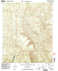
2004 Map of McFadden Peak
USGS Topo · Published 2007About this map
McFadden Peak dominates this landscape within the Tonto National Forest, where high elevations descend into a complex network of canyons and mesas. The map reveals a land management structure defined by numerous Protracted Blocks, such as PB 53 and PB 47, indicating areas where traditional section lines were not formally surveyed. Water management is critical in this environment, evidenced by scattered improvements like Reg Tank, Paul Tank, and Horse Mountain Tank.
Find a feature on this map
61 named features on this map. Tap any name to fly to it.
Don’t see what you’re looking for? This feature index may not catch every label — zoom into the map to look around manually.
Map Details
Editions of this 2004 McFadden Peak Map
This is the sole edition of this map. No revisions or reprints were ever made.
Other maps of this area

1886 · Holbrook
USGS Topo · 1:250,000

1887 · Verde
USGS Topo · 1:250,000

1892 · Verde
USGS Topo · 1:250,000

1893 · Holbrook
USGS Topo · 1:250,000

1907 · Roosevelt
USGS Topo · 1:125,000

1909 · Four Peaks
USGS Topo · 1:125,000

1912 · Roosevelt
USGS Topo · 1:125,000

1922 · Chrysotile
USGS Topo · 1:125,000

1937 · Diamond Butte
USGS Topo · 1:48,000

1943 · Diamond Butte
USGS Topo · 1:62,500