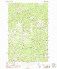
1988 Map of McGee Peak
USGS Topo · Published 1988About this map
Lolo National Forest and St Joe National Forest meet at the jagged crest of the Bitterroot Range, where the high-altitude divide also defines the border between Montana and Idaho. This 1980s provisional study documents a complex network of alpine drainages, including the headwaters of Big Creek and Deer Creek. The terrain is punctuated by several high-elevation bodies of water such as Crystal Lake, Rudie Lake, and Clear Lake, which are linked by a singular Pack Trail that traverses the ridges. This network of trails and peaks, including Mc Gee Peak and Ward Peak, reflects a landscape managed for conservation and backcountry recreation rather than industrial development. The convergence of Mineral County and Shoshone County at this remote junction highlights the cartographic importance of these summits as administrative anchors in the American West.
Find a feature on this map
36 named features on this map. Tap any name to fly to it.
Don’t see what you’re looking for? This feature index may not catch every label — zoom into the map to look around manually.
Map Details
Editions of this 1988 McGee Peak Map
This is the sole edition of this map. No revisions or reprints were ever made.
Other maps of this area

1914 · Avery
USGS Topo · 1:125,000

1917 · Avery
USGS Topo · 1:125,000

1918 · St Regis
USGS Topo · 1:125,000

1919 · St. Regis
USGS Topo · 1:125,000

1956 · Saltese
USGS Topo · 1:62,500

1956 · Wallace
USGS Topo · 1:250,000

1957 · Haugan
USGS Topo · 1:62,500

1957 · Simmons Peak
USGS Topo · 1:62,500

1960 · Wallace
USGS Topo · 1:250,000
1969 · Thor Mountain
USGS Topo · 1:24,000