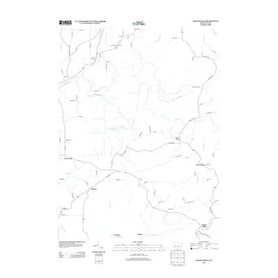
2013 Map of McGees Mills
USGS Topo · Published 2013About this map
Punxsutawney Reservoir dominates the central landscape of this Indiana County region, serving as a significant water resource amid a network of drainages including Stony Run and Clover Run. The settlement pattern follows the local creek valleys and ridges, with the historic hamlet of McGees Mills positioned near the banks of the W Br Susquehanna River in the southeast. This area exhibits the characteristic transition from agricultural plots to wooded uplands common in the Appalachian Plateaus, where small communities like Bowersville, Hillman, and Newtonburg are connected by a web of local routes such as Pike Rd and Paradise Rd. The map documents infrastructure vital to the local economy, notably the Filtering Plant Rd area near Clover Run, illustrating how water management and natural topography have shaped the development of these rural Pennsylvania townships.
Find a feature on this map
90 named features on this map. Tap any name to fly to it.
Don’t see what you’re looking for? This feature index may not catch every label — zoom into the map to look around manually.
Map Details
Editions of this 2013 McGees Mills Map
This is the sole edition of this map. No revisions or reprints were ever made.
Other maps of this area

1903 · Curwensville
USGS Topo · 1:62,500

1906 · Punxsutawney
USGS Topo · 1:62,500

1922 · Du Bois
USGS Topo · 1:62,500

1924 · Du Bois
USGS Topo · 1:62,500

1929 · Penfield
USGS Topo · 1:62,500

1932 · Penfield
USGS Topo · 1:62,500

1939 · Curwensville
USGS Topo · 1:62,500

1939 · Punxsutawney
USGS Topo · 1:62,500

1942 · Curwensville
USGS Topo · 1:62,500

1942 · Punxsutawney
USGS Topo · 1:62,500
Featured Places
- Banks Township, PA
- Sidney, Banks Township
- Flora, Banks Township
- Clover Run, Bell Township
- Henderson Township, PA