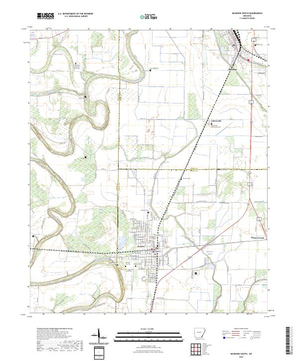
2024 Map of McGehee South
USGS Topo · Published 2024About this map
Bayou Bartholomew meanders dramatically through the center of this map, defining the landscape of Southeast Arkansas at the junction of Drew, Desha, and Chicot counties. The city of Dermott serves as a primary hub in the south, characterized by its dense grid of streets like E Gaines St and W Speedway St. To the north, the outskirts of McGehee are visible, connected to the surrounding countryside via the Short Rail Rd and State Hwy 208.
Find a feature on this map
110 named features on this map. Tap any name to fly to it.
Don’t see what you’re looking for? This feature index may not catch every label — zoom into the map to look around manually.
Map Details
Editions of this 2024 McGehee South Map
This is the sole edition of this map. No revisions or reprints were ever made.
Other maps of this area

1935 · Mist
USGS Topo · 1:62,500

1935 · Cominto
USGS Topo · 1:62,500

1936 · McGehee
USGS Topo · 1:62,500

1936 · Lake Village
USGS Topo · 1:62,500

1937 · McGehee
USGS Topo · 1:62,500

1953 · Greenwood
USGS Topo · 1:250,000

1955 · Lake Village
USGS Topo · 1:62,500

1955 · McGehee
USGS Topo · 1:62,500

1956 · Greenwood
USGS Topo · 1:250,000

1960 · Mist
USGS Topo · 1:62,500