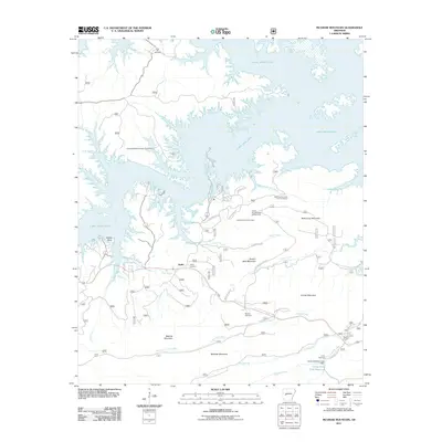
2011 Map of McGraw Mountain
USGS Topo · Published 2011About this map
The settlement of Joplin sits at the heart of this landscape, surrounded by the significant terrain of the Ouachita Mountains and the expansive waters of Lake Ouachita. The map details a complex shoreline featuring Denby Point and numerous inlets fed by watercourses like Gap Creek and Irons Creek. Local history is anchored by several burial sites, including Little Fir Cemetery to the north and Joplin Cemetery near the town center. The area's character is defined by its recreational and forest management infrastructure, visible in the Hickorynut Lookout Tower and multiple camping facilities such as the Joplin Campground and Camp Clearfork. To the south, the topography rises into named peaks like McGraw Mountain, Crystal Mountain, and Bashaw Mountain, while the southern reaches show the Camp Clear Fork Reservoir and its associated Camp Clearfork Lake Dam.
Find a feature on this map
37 named features on this map. Tap any name to fly to it.
Don’t see what you’re looking for? This feature index may not catch every label — zoom into the map to look around manually.
Map Details
Editions of this 2011 McGraw Mountain Map
This is the sole edition of this map. No revisions or reprints were ever made.
Other maps of this area

1890 · Mount Ida
USGS Topo · 1:125,000

1890 · Hot Springs
USGS Topo · 1:125,000

1894 · Hot Springs
USGS Topo · 1:125,000

1906 · Caddo Gap
USGS Topo · 1:125,000

1936 · Glenwood
USGS Topo · 1:48,000

1942 · Glenwood
USGS Topo · 1:62,500

1949 · Glenwood
USGS Topo · 1:62,500

1955 · Little Rock
USGS Topo · 1:250,000

1956 · Little Rock
USGS Topo · 1:250,000

1959 · Mount Ida
USGS Topo · 1:62,500