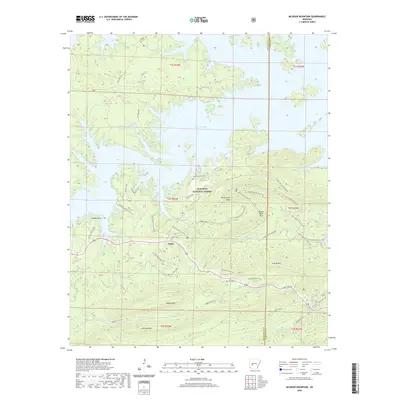
2020 Map of McGraw Mountain
USGS Topo · Published 2020About this map
Joplin sits at the heart of this landscape where the forest meets the southern shores of Lake Ouachita. The terrain is defined by the steep ridges of the Ouachita National Forest, including the prominent elevations of McGraw Mountain, Hickorynut Mountain, and Crystal Mountain. Local history and family lineages are anchored at sites like Joplin Cemetery, Little Fir Cemetery, and Murphy Cemetery, which are scattered throughout the wooded hills and along the shoreline.
Find a feature on this map
48 named features on this map. Tap any name to fly to it.
Don’t see what you’re looking for? This feature index may not catch every label — zoom into the map to look around manually.
Map Details
Editions of this 2020 McGraw Mountain Map
This is the sole edition of this map. No revisions or reprints were ever made.
Other maps of this area

1890 · Mount Ida
USGS Topo · 1:125,000

1890 · Hot Springs
USGS Topo · 1:125,000

1894 · Hot Springs
USGS Topo · 1:125,000

1906 · Caddo Gap
USGS Topo · 1:125,000

1936 · Glenwood
USGS Topo · 1:48,000

1942 · Glenwood
USGS Topo · 1:62,500

1949 · Glenwood
USGS Topo · 1:62,500

1955 · Little Rock
USGS Topo · 1:250,000

1956 · Little Rock
USGS Topo · 1:250,000

1959 · Mount Ida
USGS Topo · 1:62,500