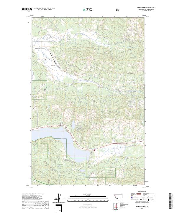
2024 Map of McGregor Peak
USGS Topo · Published 2024About this map
McGregor Peak rises above a landscape defined by the intersection of forest conservation and water management in Flathead County. The southern portion of the map is anchored by the deep blue expanse of McGregor Lake, which is bordered by the Kootenai National Forest and the Flathead County Waterfowl Production Area. This protected corridor suggests a focus on habitat preservation in a region where the topography transitions into the Cabinet Mountains to the west.
Find a feature on this map
22 named features on this map. Tap any name to fly to it.
Don’t see what you’re looking for? This feature index may not catch every label — zoom into the map to look around manually.
Map Details
Editions of this 2024 McGregor Peak Map
This is the sole edition of this map. No revisions or reprints were ever made.
Other maps of this area

1956 · Wallace
USGS Topo · 1:250,000

1957 · Kalispell
USGS Topo · 1:250,000

1960 · Kalispell
USGS Topo · 1:250,000

1960 · Wallace
USGS Topo · 1:250,000

1961 · Kalispell
USGS Topo · 1:250,000

1964 · Meadow Peak
USGS Topo · 1:24,000
1964 · Pleasant Valley Mountain
USGS Topo · 1:24,000

1964 · Hubbart Reservoir
USGS Topo · 1:24,000
1964 · Shroder Creek
USGS Topo · 1:24,000

1964 · Murr Peak
USGS Topo · 1:24,000