
1964 Map of Hubbart Reservoir
USGS Topo · Published 1967About this map
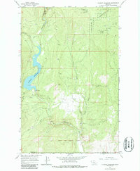
The Hubbart Reservoir serves as the central feature of this mid-1960s landscape, where the Little Bitterroot River is impounded just north of the Flathead Indian Reservation Boundary. The map documents a transition from the managed timberlands of the Flathead Nat For to the rugged drainage basins of Tamarack Creek and Briggs Creek. Notable human activity is marked by Conrad Camp on the reservoir's eastern shore and the Flathead Sunset Quarry further south. The topography is defined by the steep elevation changes surrounding Hidden Lakes and the strategic position of the Hubbard Lookout. This survey illustrates the specialized infrastructure of the era, from the Spillway to the network of unimproved roads that supported mountain access and early forest management.
Find a feature on this map
16 named features on this map. Tap any name to fly to it.
Don’t see what you’re looking for? This feature index may not catch every label — zoom into the map to look around manually.
Map Details
Editions of this 1964 Hubbart Reservoir Map
2 editions found
Other maps of this area

1956 · Wallace
USGS Topo · 1:250,000

1957 · Kalispell
USGS Topo · 1:250,000

1960 · Kalispell
USGS Topo · 1:250,000

1960 · Wallace
USGS Topo · 1:250,000

1961 · Kalispell
USGS Topo · 1:250,000
1964 · Haskill Mountain
USGS Topo · 1:24,000

1964 · Mill Pocket Creek
USGS Topo · 1:24,000
1964 · Kofford Ridge
USGS Topo · 1:24,000

1964 · Murr Peak
USGS Topo · 1:24,000
1964 · Marion
USGS Topo · 1:24,000