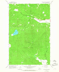
1964 Map of Haskill Mountain
USGS Topo · Published 1967About this map
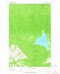
Haskill Mountain dominates the center of this 1964 survey of northwestern Montana, an area characterized by the dense drainage networks of the Flathead National Forest. This landscape is defined by the intersection of mountain timberlands and the small valley settlements found at Kessler Flats. The presence of the Ashley Creek Sch and several Gravel Pit sites along the water indicates a community structured around logging, ranching, and fundamental local infrastructure during the mid-1960s. The Idaho Trail provides a historical transit corridor through the forested terrain, connecting the high ridges to water bodies like Lake Rogers and the marshy stretches of Browns Meadow Creek. This record preserves the topography before modern development, showing the spatial relationship between seasonal forest roads and permanent mountain landmarks.
Find a feature on this map
14 named features on this map. Tap any name to fly to it.
Don’t see what you’re looking for? This feature index may not catch every label — zoom into the map to look around manually.
Map Details
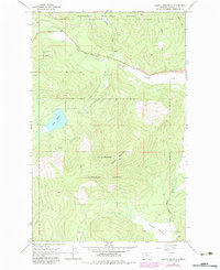
Editions of this 1964 Haskill Mountain Map
2 editions found
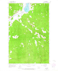
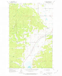
Other maps of this area

1920 · Flathead Lake
USGS Topo · 1:125,000

1943 · Kalispell
USGS Topo · 1:125,000

1956 · Wallace
USGS Topo · 1:250,000

1957 · Kalispell
USGS Topo · 1:250,000

1960 · Kalispell
USGS Topo · 1:250,000

1960 · Wallace
USGS Topo · 1:250,000

1961 · Kalispell
USGS Topo · 1:250,000
1962 · Kila
USGS Topo · 1:24,000
1962 · Blue Grass Ridge
USGS Topo · 1:24,000
1964 · Lake Mary Ronan
USGS Topo · 1:24,000