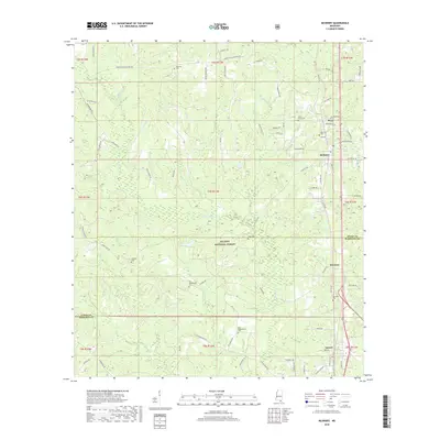
2018 Map of McHenry
USGS Topo · Published 2018About this map
The De Soto National Forest blankets the central portion of this Harrison and Stone County landscape, punctuated by a series of small, long-established settlements. Along the eastern corridor, the communities of McHenry, Howison, and Saucier are linked by the historical path of Old Hwy 49. Genealogists will find a high concentration of burial sites, including the Yellow Fever Cem near Perry, as well as the Oak Lawn Cem, Diamond Cem, and family-named landmarks like Doss Wedgeworth Cem. The topography is defined by the winding Biloxi River and numerous feeder streams such as Race Path Br and Indian Turner Br, which flow through the pine-dominated terrain. To the north, the settlement of Hickman sits near the Stone County line, surrounded by rural routes like Perkinston Silver Run Rd and Bo Hickman Rd.
Find a feature on this map
83 named features on this map. Tap any name to fly to it.
Don’t see what you’re looking for? This feature index may not catch every label — zoom into the map to look around manually.
Map Details
Editions of this 2018 McHenry Map
This is the sole edition of this map. No revisions or reprints were ever made.
Other maps of this area

1947 · Wiggins
USGS Topo · 1:62,500

1949 · Wiggins
USGS Topo · 1:62,500

1953 · Mobile
USGS Topo · 1:250,000

1954 · McHenry
USGS Topo · 1:62,500

1955 · Savannah
USGS Topo · 1:62,500

1957 · Mobile
USGS Topo · 1:250,000

1958 · Carnes
USGS Topo · 1:62,500

1960 · Mobile
USGS Topo · 1:250,000

1963 · Mobile
USGS Topo · 1:250,000

1965 · Mobile
USGS Topo · 1:250,000