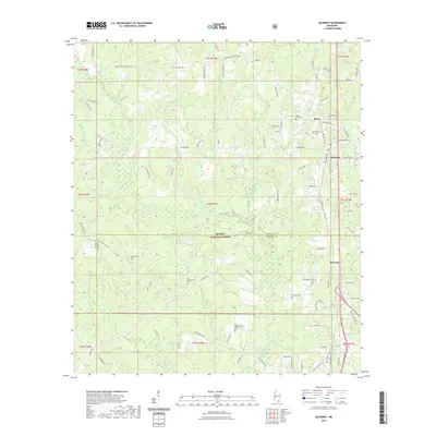
2021 Map of McHenry
USGS Topo · Published 2021About this map
McHenry and Howison stand as the primary centers of settlement in this southern Mississippi landscape, situated along the corridor of Old Hwy 49. The area is defined by its deep genealogical roots, evidenced by numerous family and community burial grounds including the Yellow Fever Cem, D C Wedgeworth Cem, and multiple locations of Hickman Cem. The terrain is dominated by the protected timberlands of the De Soto National Forest, which spans the boundary between Stone and Harrison counties. A complex network of watercourses, led by the Biloxi River and its many tributaries like Race Path Br and Indian Turner Br, drains the forested ridges. The map captures the persistence of small communities like Perry and the influence of the local timber and river-adjacent economy on the modern road network.
Find a feature on this map
97 named features on this map. Tap any name to fly to it.
Don’t see what you’re looking for? This feature index may not catch every label — zoom into the map to look around manually.
Map Details
Editions of this 2021 McHenry Map
This is the sole edition of this map. No revisions or reprints were ever made.
Other maps of this area

1947 · Wiggins
USGS Topo · 1:62,500

1949 · Wiggins
USGS Topo · 1:62,500

1953 · Mobile
USGS Topo · 1:250,000

1954 · McHenry
USGS Topo · 1:62,500

1955 · Savannah
USGS Topo · 1:62,500

1957 · Mobile
USGS Topo · 1:250,000

1958 · Carnes
USGS Topo · 1:62,500

1960 · Mobile
USGS Topo · 1:250,000

1963 · Mobile
USGS Topo · 1:250,000

1965 · Mobile
USGS Topo · 1:250,000