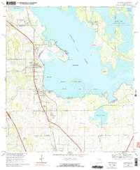
1968 Map of McIntosh
USGS Topo · Published 1990About this map
Orange Lake dominates this central Florida landscape, its waters punctuated by islands like McCormick Island and Bird Island along the border of Alachua and Marion counties. The Seaboard Coast Line railroad runs parallel to the western shore, serving a string of small settlements including McIntosh, Boardman, and Evinston. This corridor shows a pattern of early rural development, where transportation networks dictated the placement of communities and cemeteries such as Center Hill Cem.
Find a feature on this map
36 named features on this map. Tap any name to fly to it.
Don’t see what you’re looking for? This feature index may not catch every label — zoom into the map to look around manually.
Map Details
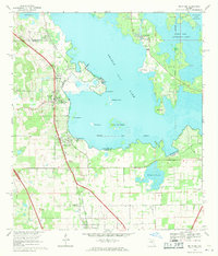
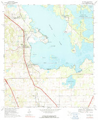
Editions of this 1968 McIntosh Map
3 editions found
Other maps of this area

1890 · Arredondo
USGS Topo · 1:62,500

1892 · Arredondo
USGS Topo · 1:62,500

1893 · Citra
USGS Topo · 1:62,500

1894 · Arredondo
USGS Topo · 1:62,500

1895 · Williston
USGS Topo · 1:62,500

1895 · Citra
USGS Topo · 1:62,500

1938 · Hawthorn
USGS Topo · 1:48,000

1943 · Hawthorn
USGS Topo · 1:62,500

1954 · Gainesville
USGS Topo · 1:250,000

1958 · Gainesville
USGS Topo · 1:250,000