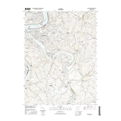
2016 Map of McKeesport
USGS Topo · Published 2016About this map
The confluence of the Monongahela River and the Youghiogheny River defines the urban and industrial landscape of McKeesport, where steep river bluffs are etched with neighborhoods and deep ravines like Boston Hollow. This modern-era survey shows a high density of religious and cultural sites, including Old Saint Joseph Catholic Cem, Temple Bnai Israel Cem, and Saint Mary's Saint Mary Czestochowa Cem, reflecting the diverse immigrant heritage of the Mon Valley. Educational and transportation infrastructure is prominent, featuring the Pennsylvania State University-Penn State Greater Allegheny campus and the Inter County Airport near the border of Allegheny Co and Westmoreland Co. While heavy industry once dominated the riverbanks, newer recreational footprints like the Kennywood Trail and the greenery surrounding Butlers Lake suggest the region's evolving land use. Smaller communities such as Buena Vista, Greenock, and Scott Haven line the winding path of the Youghiogheny as it flows northwest through the quadrangle.
Find a feature on this map
105 named features on this map. Tap any name to fly to it.
Don’t see what you’re looking for? This feature index may not catch every label — zoom into the map to look around manually.
Map Details
Editions of this 2016 McKeesport Map
This is the sole edition of this map. No revisions or reprints were ever made.
Other maps of this area

1902 · Brownsville
USGS Topo · 1:62,500

1902 · Connellsville
USGS Topo · 1:62,500

1904 · Mc Keesport
USGS Topo · 1:62,500

1904 · Greensburg
USGS Topo · 1:62,500

1906 · Brownsville
USGS Topo · 1:62,500

1906 · Greensburg
USGS Topo · 1:62,500

1907 · Pittsburg
USGS Topo · 1:62,500

1931 · Brownsville
USGS Topo · 1:62,500

1931 · Connellsville
USGS Topo · 1:62,500

1933 · Brownsville
USGS Topo · 1:62,500