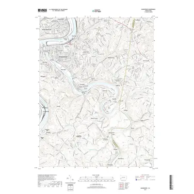
2019 Map of McKeesport
USGS Topo · Published 2019About this map
The Monongahela and Youghiogheny River converge at McKeesport, defining a landscape of industrial river towns and sprawling hilltop cemeteries. This survey captures the dense urban corridors of Duquesne and West Mifflin alongside the established neighborhoods of White Oak and Versailles. The sheer number of religious and ethnic burial grounds, such as Saint Nicholas Saints Peter and Paul Byzantine Catholic Cem and Temple Bnai Israel Cem, reflects the deep immigrant heritage of the Mon Valley. Educational and transportation hubs are prominent, from the Penn State Greater Allegheny campus to the Inter County Airport. Further south, the terrain transitions into the steep ravines of Boston Hollow and Possum Hollow, where smaller settlements like Buena Vista and Blythedale follow the river's winding course.
Find a feature on this map
107 named features on this map. Tap any name to fly to it.
Don’t see what you’re looking for? This feature index may not catch every label — zoom into the map to look around manually.
Map Details
Editions of this 2019 McKeesport Map
This is the sole edition of this map. No revisions or reprints were ever made.
Other maps of this area

1902 · Brownsville
USGS Topo · 1:62,500

1902 · Connellsville
USGS Topo · 1:62,500

1904 · Mc Keesport
USGS Topo · 1:62,500

1904 · Greensburg
USGS Topo · 1:62,500

1906 · Brownsville
USGS Topo · 1:62,500

1906 · Greensburg
USGS Topo · 1:62,500

1907 · Pittsburg
USGS Topo · 1:62,500

1931 · Brownsville
USGS Topo · 1:62,500

1931 · Connellsville
USGS Topo · 1:62,500

1933 · Brownsville
USGS Topo · 1:62,500