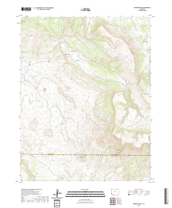
2022 Map of McKenna Peak
USGS Topo · Published 2022About this map
McKenna Peak rises as a dominant landmark in this southwestern corner of Colorado, where the high desert meets the canyonlands along the boundary of San Miguel and Dolores counties. The landscape is defined by an intricate network of drainage systems, including Still Canyon and Wildcat Canyon, which carve through the plateaus toward the wide valley of Disappointment Cr. This 2022 survey reveals a terrain shaped by both geologic forces and a history of ranching and land claims, evidenced by features such as Horse Park, Bassnet Point, and the provocatively named Desert Claim.
Find a feature on this map
29 named features on this map. Tap any name to fly to it.
Don’t see what you’re looking for? This feature index may not catch every label — zoom into the map to look around manually.
Map Details
Editions of this 2022 McKenna Peak Map
This is the sole edition of this map. No revisions or reprints were ever made.
Other maps of this area

1916 · Paradox Valley
USGS Topo · 1:125,000

1922 · Paradox Valley
USGS Topo · 1:125,000

1948 · Gypsum Gap
USGS Topo · 1:24,000

1949 · Gypsum Gap
USGS Topo · 1:24,000

1956 · Cortez
USGS Topo · 1:250,000

1956 · Moab
USGS Topo · 1:250,000

1958 · Cortez
USGS Topo · 1:250,000

1959 · Cortez
USGS Topo · 1:250,000

1959 · Moab
USGS Topo · 1:250,000

1960 · Moab
USGS Topo · 1:250,000