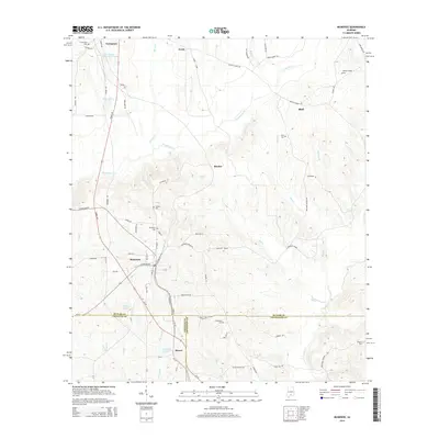
2014 Map of McKenzie
USGS Topo · Published 2014About this map
McKenzie sits at the junction of several county lines in southern Alabama, serving as a central hub between the smaller communities of Shreve, Rhodes, and Shell. The landscape is defined by a dense network of watercourses, including Persimmon Cr, Mill Cr, and Riley Cr, which carve through the terrain south of Georgiana. This 2014 survey reveals a significant focus on local genealogy, preserving the locations of numerous family and community burial grounds such as Friendship Cem, S Butler Cem, and Bushfield Cem. The southern portion of the map highlights the convergence of Butler, Conecuh, and Covington counties. Transportation routes like Mobile Rd and McKenzie Grade connect these rural settlements, while smaller features like Majors Lake and Container Corporation Lake dot the woodsy topography.
Find a feature on this map
81 named features on this map. Tap any name to fly to it.
Don’t see what you’re looking for? This feature index may not catch every label — zoom into the map to look around manually.
Map Details
Editions of this 2014 McKenzie Map
This is the sole edition of this map. No revisions or reprints were ever made.
Other maps of this area

1953 · Andalusia
USGS Topo · 1:250,000

1957 · Andalusia
USGS Topo · 1:250,000

1971 · Brooks
USGS Topo · 1:24,000

1971 · Industry
USGS Topo · 1:24,000

1971 · Pigeon Creek
USGS Topo · 1:24,000

1971 · Mc Kenzie
USGS Topo · 1:24,000

1971 · Red Level
USGS Topo · 1:24,000

1971 · Georgiana East
USGS Topo · 1:24,000

1971 · Garland
USGS Topo · 1:24,000

1971 · Georgiana West
USGS Topo · 1:24,000