
1970 Map of McKenzie Lake NW
USGS Topo · Published 1973About this map
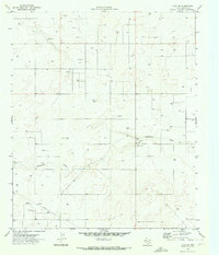
The Huat Oil Field dominates this 1970 landscape in Gaines County, revealing the intensive petroleum development characteristic of the Permian Basin during this era. Scattered across the terrain are numerous Oil Wells, supported by a network of unimproved roads and an intersecting Pipeline. In the southern portion of the sheet, the natural topography is defined by the winding path of the Seminole Draw. This drainage feature provides a stark contrast to the industrial footprint, though even here, the influence of ranching and extraction is evident through features like the Cedar Point Windmill and several Gravel Pits. The map documents a workspace of high-desert industry where fence lines and section corners dictate a rigid geometry over the open Texas plains.
Find a feature on this map
11 named features on this map. Tap any name to fly to it.
Don’t see what you’re looking for? This feature index may not catch every label — zoom into the map to look around manually.
Map Details
Editions of this 1970 McKenzie Lake NW Map
This is the sole edition of this map. No revisions or reprints were ever made.
Other maps of this area

1954 · Hobbs
USGS Topo · 1:250,000

1958 · Hobbs
USGS Topo · 1:250,000

1970 · Seminole NE
USGS Topo · 1:24,000

1970 · Cedar Point Ranch
USGS Topo · 1:24,000

1970 · Seagraves SE
USGS Topo · 1:24,000

1970 · Seminole SE
USGS Topo · 1:24,000

1970 · McKenzie Lake SE
USGS Topo · 1:24,000
1970 · Loop SW
USGS Topo · 1:24,000

1970 · McKenzie Lake
USGS Topo · 1:24,000
1970 · Cedar Point
USGS Topo · 1:24,000