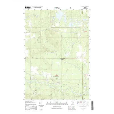
2017 Map of McKinley
USGS Topo · Published 2017About this map
The McKinley settlement serves as the focal point of this northern Michigan landscape, situated along the southern banks of the Au Sable River. Located within the boundaries of the Huron National Forest, the area is defined by a dense network of water bodies and trails, including Lake David, Island Lake, and Penoyer Lake. Genealogists and local historians will find the McKinley Cem located just north of the town center, providing a vital link to the community's early residents. The map captures a transitional landscape where forest management and recreation intersect, marked by numerous logging-era remnants like the Hardy Grade and Old Hardy Grade. Transportation is largely dictated by forest roads and recreational routes such as the Mack-McKinley Trail and the Mi Shore to Shore Horse&Hike trail, which traverse the undulating terrain toward the Oscoda and Alcona county line.
Find a feature on this map
52 named features on this map. Tap any name to fly to it.
Don’t see what you’re looking for? This feature index may not catch every label — zoom into the map to look around manually.
Map Details
Editions of this 2017 McKinley Map
This is the sole edition of this map. No revisions or reprints were ever made.
Other maps of this area

1954 · Traverse City
USGS Topo · 1:250,000

1954 · Tawas City
USGS Topo · 1:250,000

1955 · Comins
USGS Topo · 1:62,500

1958 · Traverse City
USGS Topo · 1:250,000

1958 · Tawas City
USGS Topo · 1:250,000

1972 · McKinley
USGS Topo · 1:24,000

1972 · Curran
USGS Topo · 1:24,000

1972 · McCollum Lake
USGS Topo · 1:24,000

1972 · Goodar
USGS Topo · 1:24,000

1972 · Mack Lake
USGS Topo · 1:24,000