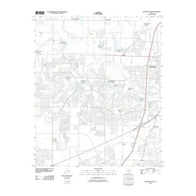
2010 Map of McKinney West
USGS Topo · Published 2010About this map
McKinney and its western periphery show a landscape in rapid transition as suburban development meets agricultural history. The creek systems, including Wilson Creek and its many tributaries like Rutherford Branch and Franklin Branch, are punctuated by an extensive series of flood control structures managed by the Soil Conservation Service. These reservoirs, such as Soil Conservation Service Site 3a Dam, serve as the anchors for modern residential planning, with winding street networks filling the gaps between traditional landholdings.
Find a feature on this map
76 named features on this map. Tap any name to fly to it.
Don’t see what you’re looking for? This feature index may not catch every label — zoom into the map to look around manually.
Map Details
Editions of this 2010 McKinney West Map
This is the sole edition of this map. No revisions or reprints were ever made.
Other maps of this area

1924 · Mc Kinney 4-d
USGS Topo · 1:48,000

1929 · Frisco
USGS Topo · 1:62,500

1929 · McKinney
USGS Topo · 1:62,500

1954 · Sherman
USGS Topo · 1:250,000

1958 · Sherman
USGS Topo · 1:250,000

1959 · Wylie
USGS Topo · 1:24,000

1960 · Frisco
USGS Topo · 1:24,000

1960 · McKinney East
USGS Topo · 1:24,000

1960 · Celina
USGS Topo · 1:24,000

1960 · Plano
USGS Topo · 1:24,000