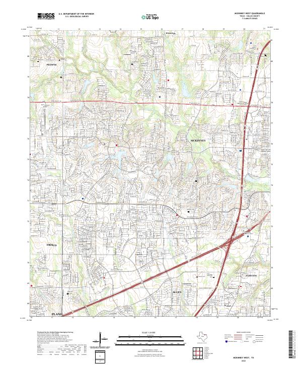
2022 Map of McKinney West
USGS Topo · Published 2022About this map
McKinney and Frisco serve as the primary anchors for this part of Collin County, capturing a landscape in the midst of rapid suburban transition. The western expansion of McKinney is clearly marked by the Collin College McKinney Campus Central Park and the Collin County Courthouse, while the surrounding terrain is still defined by its natural drainage into Wilson Creek, Rowlett Creek, and Franklin Branch. Traces of the area's rural foundations remain visible through several scattered family burial grounds and historical sites, including Wear Cemetery, Scott Cemetery, and the County Poor Farm Cemetery.
Find a feature on this map
433 named features on this map. Tap any name to fly to it.
Don’t see what you’re looking for? This feature index may not catch every label — zoom into the map to look around manually.
Map Details
Editions of this 2022 McKinney West Map
This is the sole edition of this map. No revisions or reprints were ever made.
Other maps of this area

1924 · Mc Kinney 4-d
USGS Topo · 1:48,000

1929 · Frisco
USGS Topo · 1:62,500

1929 · McKinney
USGS Topo · 1:62,500

1954 · Sherman
USGS Topo · 1:250,000

1958 · Sherman
USGS Topo · 1:250,000

1959 · Wylie
USGS Topo · 1:24,000

1960 · Frisco
USGS Topo · 1:24,000

1960 · McKinney East
USGS Topo · 1:24,000

1960 · Celina
USGS Topo · 1:24,000

1960 · Plano
USGS Topo · 1:24,000