2024 Map of McLain
USGS Topo · Published 2024About this map
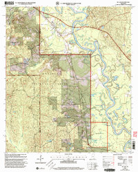
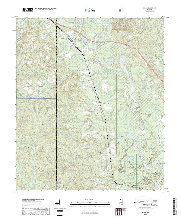
The Leaf River and its intricate network of oxbows and dead rivers, such as Hillman Dead River and Daughdrill Dead Lake, define the geography of this Greene County landscape. The town of McLain serves as a central hub, situated where the Canadian National RR crosses the river valley. The southern portion of the map is dominated by the protected lands of the De Soto National Forest and the Leaf Wilderness, alongside a section of the Camp Shelby military boundary. Genealogists will find several burial sites including McLain Cem, Leaf Cem, and Mount Nebo Cem. Small settlements like Leaf, Royce, and Benjoe are connected by a web of local roads, including Old Federal Rd, reflecting the rural character and timber-rich history of southeastern Mississippi.
Find a feature on this map
97 named features on this map. Tap any name to fly to it.
Don’t see what you’re looking for? This feature index may not catch every label — zoom into the map to look around manually.
Map Details
Editions of this 2024 McLain Map
This is the sole edition of this map. No revisions or reprints were ever made.