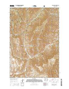
2014 Map of McLain Gulch
USGS Topo · Published 2014About this map
Whitman National Forest dominates the terrain of this quadrangle, where the steep drainages of the Eagle Cap area meet the lower elevations of the Snake River watershed. The settlement of Pine Creek sits along the Baker-Copperfield Hwy and Or-86, representing a vital transit point for the region's historic mining and ranching industries. High-country landmarks such as Grouse Flat and Plummer Gulch offer insights into the early land management and grazing patterns of Baker County.
Find a feature on this map
40 named features on this map. Tap any name to fly to it.
Don’t see what you’re looking for? This feature index may not catch every label — zoom into the map to look around manually.
Map Details
Editions of this 2014 McLain Gulch Map
This is the sole edition of this map. No revisions or reprints were ever made.
Other maps of this area

1915 · Pine
USGS Topo · 1:125,000

1954 · Cornucopia
USGS Topo · 1:62,500

1955 · Baker
USGS Topo · 1:250,000

1955 · Grangeville
USGS Topo · 1:250,000

1957 · Halfway
USGS Topo · 1:62,500

1957 · Homestead
USGS Topo · 1:62,500

1957 · Copperfield
USGS Topo · 1:62,500

1959 · Baker
USGS Topo · 1:250,000

1959 · Grangeville
USGS Topo · 1:250,000

1980 · McCall
USGS Topo · 1:100,000